Tuesday 25 April 2017


Two more sleeps and then we are gone - NW!
Great adventure ... and we made it right to the tippy tip tip of Cape York Peninsula 2015
Having just been to the southern most point of Oz, we're heading off to find the other northern most point in Oz. No, not 'The Tip' of Cape York Peninsula (we were there in 2015), but the Top End - places like Arhnem Land and world renowned National Parks and wilderness preserves.
We will be travelling up the Stuart Hwy through The Alice to reach Kakadu while there’s still plenty of water around - we hope. A place that's been on my list for many years is the Cobourg Peninsula. We'll be heading there next - Garig Gunak Barlu National Park, Arnhem Land (350 km east of Darwin) followed maybe by a trip out to the Tiwi Islands which are not too far off shore from Darwin, 'near' the Cobourg Pen and part of that whole scribbly piece of coast line.
On our list also are places that seem so remote and magical - Katherine gorge, the Adelaide River, Litchfield National Park, the Kimberleys, Gibb River Road (a look see at least)  .. and who know where else. Kunanurra, Lake Argyle, Ord Rover, Bungle Bungles, King Leopold Ranges, Fitzroy Crossing and …..
We are packed to the gunwales with all manner of back up equipment and rescue gear .... and tons of food (and wine), but of course! We've also pack lots of other things to keep us on track - both of us subscribe to a range of online learning courses but I also take a range of reference books on plants and rocks, etc and fungi of course. I would so love to see desert fungi - seems there are heaps. I will just have to keep me eyes open.
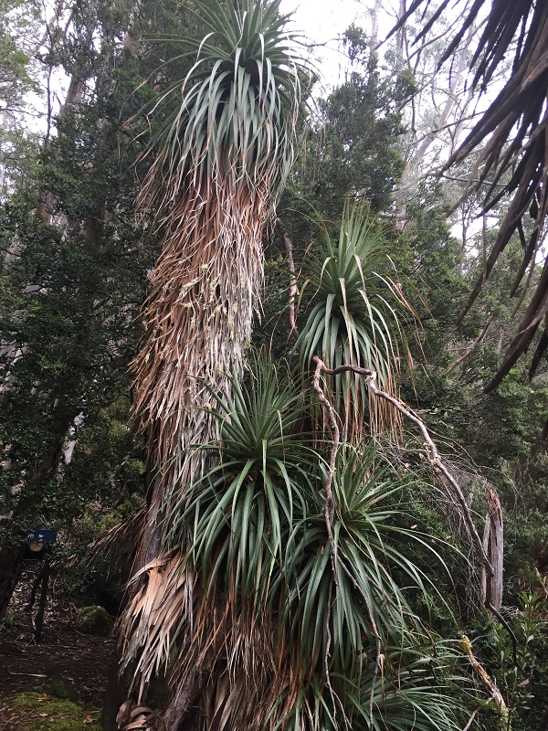
Travel for me is about exploring places and 'things' I don't know about or about which I have forgotten. For example in Tassie I learned about the discovery and settlement of the Furneaux group of islands in Bass Strait. Each trip sends me back to books or to Google to learn more about matters big and small. I learnt so much on our Tassie trip but I won't bore you with my ravings! But maybe just one question - what causes hexagonal granite formations? So many questions. Thank goodness for Google and of course visitors centres are wonderful sources of all manner of information. You can take it or leave it but explore a little and a whole new book opens and once you're hooked. The internet is a mine field of treasures - when you have internet - and where we're going there wont be much, oh well. We'll be off the grid, unplugged for much of the time. Marvellous!!
​We're all at sea! 13 April
Ships passing in the day! The sister ship with a load of people bound for Van Deimen's land.
I woke to the deep throbbing of engines as the Spirit pulled in to Devonport dock - well before dawn. An early start with a rushed coffee before lining up for the long wait to board. Ah the horror of return journeys, the interminable waiting, the sadness of leaving great places yet tinged with excitement for home and the next/promised journeys!
As the sun sets slowly over Port Phillip Bay we drank a toast to our next journey.
It was a perfect crossing. Little swell, sunshine and we were through the Heads before we knew it - didn't feel even the slightest swell. Just lucky I guess. So ends a fantastic visit to the apple isle. Next time ...? There are still walks to do, still birds to find, still glorious fungi to discover. Next time we'll come in winter or at least late Autumn when the endemic deciduous beech (Nothofagus gunnii not the myrtle beech Nothofagus Cunninghamii - so my book says!) is turning gold-red and the fungi are coming into their own. I have still to find a liverwort - next time!!
Our fair city sitting pearly in the approaching dusk. Lovely!
For now, a mere 2 weeks in Melbourne before we hook up the old girl again - the van! I'm already hooked haha - and point our wheels towards parts north and west. Heading for Kakadu and Cobourg Peninsula and elsewhere to magical places with names that fascinate - Litchfield, Katherine, the Bungle Bungles, Gibb River Road, the Ord river, Fitzroy Crossing.

Chat to you from along the road.
​Cradle mountain revisited - Wednesday 12 April
The walk passes through eucalypt woodlands and button grass and heath regions
The woodlands were ablaze with 'mountain currants'
They tasted like unripe tomatoes

These are Pepperberry and as the name suggests they have a really peppery kick
We encountered so many berries (the brown bears would love it). All quite edible albeit not always terribly palatable.
Yesterday was a perfect day to end a wonderful, fabulous, exciting and rewarding time travelling in Tassie - we revisited Cradle Mountain NP for a final walk. The weather was superb - not too hot, not too cold, just right.
Having walked around Dove Lake at the beginning of our Tassie odyssey and being blown away by the beauty of the area we decided we wanted to come back some time to walk the Cradle Mountain Boardwalk. And so we did! The path meanders ​beside Dove River from the Ranger station to Ronny Creek where the Overland track begins. (We we also took a couple of other very short walks).
Amazingly this walk is ALL boardwalk which seemed so incongruous in this wilderness and such a luxury after some of the walks we've done, but the paths are designed to protect a fragile and precious environment from being trampled by people wandering all over the shop - 'plants grow by the inch but die but the foot!'
They all seem to go up! Lindsay reckons we walked up well over 400 steps;
way beyond Jacob's ladder. Where would we end up? 
It was easy going - except for all the ..... steps! They all seemed to to go up - I don't recall too many downs but ..... We take our time and stop for breaks when needed.
This little chap quietly chomped on the button grass close to the board walk.
What an adorable face. 

This is a tireless eating machine (the wombat!).
We saw the lots of evidence of that on the boardwalk!!
We encounter a bit of wild life. Got up close and personal with this adorable wombat, Bennetts wallaby, a metallic skink, saw the scat of other animals including Tassie Devils and almost missed this gorgeous moth minding its own business in a rock out of the wind. Of course we saw some fungi! but I reckon you might be all fungied out so I'll only show you one. You realise that most fungi usually grown on the ground, right? Well think about that when you contemplate me taking a shot of the underside of this little beauty, which was about 12cm across - yep almost standing on my head!
A metallic skink minding its own business

I think this is one of the Russula (in the group of Agarics which are fungi with true gills). Because I'm a curious cat always wanting to know everything, I travel with some great resources - TreeFlip, EucaFlip and FungiFlip which are wonderful colourful charts of some of Tassies lovely 'flora'. Also carry a great little reference written by Bruce Fuhrer, Aussie micologist and fungi photographer. (For other states I have various books on plants and rocks.)

No idea what species of moth this is but it caught my eye - look at his gorgeous hair do. 
Awesome view of Cradle Mountain! We were getting close to the end of our walk.
Pencil Pine Falls. Rivers and creeks were lined with leatherwood (some flowers still evident),
celery-top pine (which is not a pine but has the overall shape of some pines),
and humongous ancient craggy pencil pine 

It was a lovely day and we were sad to leave but leave we did, each harbouring secret longings to walk the Overland track.

We headed for overnight in Devonport ready for the Spirit . After a yummy fish and chip dinner we bunked down for an early start in the morning.
Roll on the next adventure! Talk to you up the track to the northern tip of Oz.
Bridport, Ringarooma, North East Tassie - 10 to 11 April

On our way north west to find a caravan park WITH power, we took some challenging steep windy roads and through lots of rain but when the clouds parted, the scenery over mountains and through the valleys of the high plains was delightful. From the forested rugged mountain sides to the bucolic lushness of the valleys - we decided to return for a better look the next day.
We had the honey moon site at Bridport caravan park AND quiet!
And that's just what we did and took a windy track south of Ringarooma into Mt Victoria National Park to check out Ralphs Falls - from Norms Lookout ... brothers perhaps? At 90m, the Falls is Tasmanias highest single drop waterfall. Its quite an amazing ribbon of water dropping over a sheer rock wall. The walk back from the Falls was rather special as I spotted a glorious burst of colour poking out of the base of a moss-covered tree. It deserved a closer look and a photo of course. This gorgeous thing has to be one of my favourites so far together with Russula and ....... they are all gorgeous or fascinating. [If you're interested in fungi go to Tasmanian fungi Facebook page or check out thegumbootchronicles.com which I have only just discovered.]
Aurantiporus pulchemmins - a real whopper 10 x 15cm.
It was growing out of the base of a moss-covered tree - I am down on the ground looking up!
We took the scenic route back to the van poking along the coast, when we could access it, and in and out of coastal villages such as Tomahawk whose beach late afternoon was rather peaceful.
Tomahawk is a small seaside village on Bass Strait in NE Tassie
(Note I seem to have a lot of moody sky shots - interesting that!)
The next day was to be our last in Tassie and we had special plans in mind!!

​Freycinet Peninsula 7 April
The Hazards from Moulting Lagoon
Moulting Lagoon Game reserve on the Freycinet Peninsula - hello here we are, or rather there we were, camped in relative quiet without water and power, but a mere hop, step and jump from the lagoon and away from the increasing madding crowd flocking to the tourist spots of this world famous peninsular. Natural bush and some exotics (like beautiful wild passion fruit) and loads of birds surrounded us on one side and on the other is the lagoon opening into Coles Bay.
Our camping spot for the night - surrounded by quiet bush,

While I was snapping this spectacular passion flower,
a bee dropped in for afternoon tea.
Standing on the edge of the lagoon, to my east I can see the nubbly piles of giant granite tors of The Hazards which form the stony spine of the peninsular, jutting into the sky and to my west in the near distance are oyster beds and lots of water birds. In front of me on the mud flats, the silence and stillness is broken only by the popping and snapping of crab holes and the occasional swish of bird wings. It's lovely.
The boat that would take us into the open sea! Looks more like a harbour boat to me.
The rocky Hazards in the background. Our cruise was to take us to the seaward side of the
peninsula  - Wineglass bay, in line eastward with this point. 
After a kick-back night around a brilliant camp fire, we emerged from 'the bush' for what we hoped would be a decadent lunch cruise from Coles Bay to Wine Glass Bay. Variety is the spice of life!
The cruise took us along the west coast of the peninsular with lots of photo ops. We came upon a pod of dolphins, or they found us! and we circled each other for 20 mins or so. It was really something to see them almost touching the boat when they came up for air. It is likely that they are part of the same large pod of bottle-nose dolphins mainly resident in Great Oyster Bay, which we were sailing through, and part of the pod we encountered on our Maria Island trip.
The Hazards overlooking Wineglass Bay which is to the left of this.

Lemon Rock, the rocky cluster in the foreground, at the mouth of the bay once housed a lighthouse.
The open sea, once we rounded the southern tip of the peninsular and 'bobbed' our way through the Scholten passage barely an hour into the trip, was rough and a third of the passengers got very very sick. Poor things! I really felt for them. The condition of the sea, we believe, prevented the expected stop in Wineglass bay for lunch, but we weren't told. It was well over three and a half hours before we dropped anchor for lunch and most passengers were rather hanging out for something to quell rumbling and seedy tummies. It was a rather disappointing cruise - apart from the dolphins! But there you are ......
We pulled into this spot close to 2pm for lunch!
The water here on the west of the peninsular was relatively calm and beautiful.
Once back on terra firma, we hopped back in the van and headed for the Bay of Fires and Cosy Corner where we had spent a few idyllic days back in 2013.
Bay of Fires is so beautiful - this is Cosy Corner

Cosy Corner in 2013 - not a soul there but us!  What a contrast (NB different car)
We traveled over 6000 Km on that Tassie trip; this  trip we did 7500 Km.
Between those trips our trusty little caravan has done ~17500 Km. What a cracker!
It just wasn't our day! Firstly the place was chock-a-block with campers and when we finally found a spot at another place, we unhooked only to find we had no battery power. That meant no hot water but worse than that, no water pump for any temperature water, no lights but hey .....  To top it off it started to drizzle so no camp fire. Oh dear! But we are hardy souls. We always have loads of food and the good stuff, a gas stove and lots of bottled water and we dined by lit candles and made do. It was fine. Next day we high-tailed it out of there!
We ended up at Bridport on what the manager called his honeymoon site overlooking the sea with the water and rocks at our very door step - almost. The day ended well!

Monday 24 April 2017

​Maria Island - history and wild life

Prologue: we tried to visit Maria Island in 2013 but access was closed because some major maintenance works were underway. So it was a place we promised to get to this trip if not simply to explore, then to have a shot at spotting the 40 spotted pardalotte!! 70% of the world population lives in the white gums there.
Triabunna Port, where we hopped on board for Maria Island.
Triabunna is the aboriginal word for the native hen
which is nicknamed locally 'Turbo Chook'
Named by Tasman in the 1600s, Maria Island predates Port Arthur as a convict settlement. Here endth the lesson for today - oh expect to tell you that a number of Tassie devils has been released on the island with the hope of increasing the population of healthy, cancer-free animals. In fact the island was seen as a modern day Noah's ark to which a number of endemic species were 'transported' as a means of protecting them for posterity. We know about translocation, don't we!? Looks like Tassie is the destination for many 'translocated' species - both human and non human! Hmmmm .....
Mrs Hunts cottage. She operated a pedal wireless in this isolated spot
(the beginnings of WiFi - think about it you remember the old wireless!!) in the early 1900s
to maintain communication with mainland Tassie.  What a woman!
These cliffs are stunning to behold.  We walked as far as we dared over rocks,
making the dash between waves. So we didn't get as close as we would have liked.
We wandered for ~5 hours from the painted cliffs which are stunningly layered, worn sandstone incorporating colours introduced by many minerals, inland to a reservoir built by convicts in the early 1800s. We passed by the original convict settlement which was later rebirthed as a productive, industry-based settlement base.
Our walking poles - one of the best purchase we have ever made,
helped us across many a rocky or dubious surface.
The island provided a source of lime stone for the concrete industry (the lime silos remain), produced grapes sufficient for a small wine industry, produced silk! (no idea what and how), and also dabbled in farming and fishing. An amazing history!
The Commissariat and cement silos. Silent reminders of a 'productive' past,
We saw none, but I heard the insistent chirp of the now believed (by Lindsay) mythical 40 spotted pardalote.
It was a fascinating day and we returned home into the setting sun surrounded by dolphins. Tra la la
Is that a sky or is that a sky?!
I can almost see the cherubs peeking over the edge of the clouds.

Thursday 20 April 2017

Bruny Island - a quiet escape 29 March to 4 April

We returned to Bruny after 4 years to search for the 40 spotted pardalote - well Lindsay did, but really we were there because we love the quietness of the island and again we camped at Adventure Bay, South Bruny. The twin-set of islands - North and South - are joined by a narrow neck of land little more than the width of a dirt road and beach at some points and no greater than 50 meters. Over 6 days we explored from one end of duo to the other - and took another wildlife cruise. Of course!
Togged up like red penguins on the Pennicott Wilderness cruise 

Monument Rock in the South Bruny National Park.
The boat went through that narrow passage - exciting!
The cruise took us passed the towering dolerite cliffs - some of the most imposing in the world, deep sea caves and blow holes of Fluted Cape, and on along the coast of South Bruny National Park. We then turned south away from the island and zoomed out to The Friars, island sanctuaries for fur seals and sea birds. The rocks were a seething mass of sleek brown bodies hefting themselves around, diving in and climbing out of the roiling sea, bickering, arguing and playing with each other. Beautiful creatures! The birds, mainly black faced cormorants, sat on bird-snow encrusted rocks silent sentinels to the silly antics of the seals. The Friars mark where the Tasman meets the Southern Ocean.
'Breathing Rock' explodes water every minute

Rough water off Friars Islands
It was exhilarating banging along just skimming the peaks of the big ocean swells. We were looking for fish and birds. And we found them! Great swooping, soaring albatross, rather magnificent things! Short-tailed Shearwaters dipped and fluttered, glided and turned along side our boat. Great circles 40 m across boiled with masses of fish obviously driven up to the surface from the deep by who knows what big fish herding them together for a feed.
Australia fur seals sunning themselves on the jagged rocks - ouch!
they have their own inbuilt Sealy Posturepedic (groan!)

The icing on the cake! Cormorant heaven on one of The Friars
Back on land, we took a slightly beaten track first along the beach and then through woodlands to Grassy Point, a mere stone's throw from Penguin island and walked from there over the cliff through to look down on the wild sea bashing against the rocks of Fluted Cape.
The lump top right is Penguin island. Not because it has any penguins
living on it but because an early explorer saw a Macaroni penguin (one!)
as they sailed into Adventure Bay.  
After a few days of patchy rain (and some snow on high peaks) we took a walk through coastal heath and eucalypt forests on Point Labillardiere, in the South Bruny National Park. I felt a little like Maria on the alps- the hills were almost alive with the sound of music. Tra la la ......: totally alone - it seemed! The heathland was a panoramic Pandora's box of tiny coloured shapes. Flowers and plants I couldn't name but of a myriad of colours and shapes. The walk ended with stretches along the hard packed sand of hidden coves. Oh la! Brings out the inner poet ..... hmmm.
The walk on Point Labillardiere. The heathland was so wild and beautiful.
We emerged out of the forest to walk along secluded beaches

We felt like we were the only people alive. Glorious!
 Lindsay went searching through white gum scrub for the elusive 40 spotted pardalote and saw one briefly. They remain entirely elusive, a draw card to return. And there are still many walks to do and places to explore or rediscover like Cape Queen Elizabeth.

Monday 10 April 2017


Cockle Creek - a short week unplugged!
We were entertained by flocks of Green Rosellas who
perched in the tree above us morning and night 
We were aiming for a special spot, Bolton Green, at the end of the southern-most road in Australia, just south of Cockle Creek and inside the Southwest National Park where we had stayed in misty isolation 4 years ago. 'The End of the Road'. But it was not to be - 'our spot' was filled with campers. Dam! So we back-tracked a few 100 metres just across the creek and camped in a non NP area which meant we could have a fire - whoopee! And we did. A little beauty in a ring of rocks fueled by a little local scavenged wood and the stash of wood and cones that we had brought with us. The smell of the fire was intoxicating and reminiscent of romantic nights by other fires in 'the bush'.
Prawns this night but we enjoyed other delicious meals en plein air
This was Cockle Creek and there were cockles aplenty,
but there were also lots of mussels and oysters which were
 humongous and hard to open for amateurs
we now have an oyster shucking knife but .....
Recherché Bay was just through the tea trees and we could hear the water gently lapping on a narrow white beach. And on the other side of us Cockle creek. Absolutely beautiful, idyllic.
Cockle Creek is where the South Cape track to Melaleuca starts/ends and sits on the edge of the 600,000 hectares of the Southwest National Park. We walked the first bit of the track through to South Cape Bay 4 years ago - it was a bit challenging but the view out over the Southern ocean when we got to the bay was worth it. In spite of good intentions, we didn't do the walk this time - felt there were other things to explore (and we needed to conserve some energy!).
Simply gorgeous
First morning there we woke to silence except for the lazy droning of big woolly bumble bees and the sound of waves breaking on the shore 30 m away. Joy oh joy! (Let's forget the long drop for a moment and focus on the Natural beauty - ok!?)
It was a time of chilling out and taking each day as it came. We walked to Fisher Point, the southern tip of Recherché bay where a whaling station once stood. In fact there once were many whaling stations along this coast - a dark past indeed. We wandered along the beach, through tidal pools and over dolerite boulders smeared with yellow and white lichen, gathered Bay leaves from a tree which is the only remaining sign that once a 'homestead' stood there. We picked bunches of leaves and hung them around the van to dry; I also 'freeze dried' some in the freezer.
The cockles were many layers deep under our feet
 We took off our shoes and went wading in the creek feeling for cockles with our feet - we gathered over a kilo of shells! Took ages to clean them all but it was worth it. That night we gorged on cockles cooked with chilli, garlic and lemongrass (in wine of course) with pasta. Inspired by our hunter-gatherer success we went out for oysters and mussel the next morning. The oysters here are monstrous. They made a great meal simply baked on a hot plate nestled in the coals of our camp fire. Yummo!! Life doesn't get much better than this! All a bit of an experiment really.

It was a two phase process - I got to scrub each little beauty with
a rather too small brush - we have since bought a bigger one!
We lunched at Australia's southern most pub one day, visited bays and beaches and read the head stones on graves of pioneering families of the area. What privations they endured! One woman and her son went out to find some of their cattle and never returned. Tragic stories reached out to us from scant recordings on those head stones.

We spent part of a day in the Hartz mountains National park. Plans to walk to a glacial lake were dashed by a sudden torrential storm with slanting rain, sleet and gale force winds. But we managed to get a look out over old myrtle forests in the Huon valley and walk through snow gums and alpine herb fields to Arve falls where the river tumbles over the escarpment into the valley below. It was a hurried trip as the weather was closing in - the weather is unpredictable in these mountains. We ended up absolutely drenched to the skin but it was worth it for the awesome sight of the falls - a bit scary looking way down into the valley.
Something I learned about that cold place was that it is home to a small frog unique to Australia - recently discovered. Unlike any other frog it doesn't live in water for any part of its life cycle. It lays its eggs on damp moss and the froglets don't go through the tadpole stage. Cool eh!?
The Ides of March! as we make our way slowly south east.
It's not all big days and bucket list stuff! Many days have been spent simply - going for drives into the hills, along rivers and streams, picking wild blackberries, fennel for our fish, and a new one for me, rose hips (they are still drying). New Norfolk along the Derwent is lovely. Lots of hops and other good things produced around there.
First night we were joined at Happy Hour by this little darling
We camped at Mt Field National Park for 3 days - it's a place we really love. Totally different to west coast and central highlands. Did lots of walks including 6 k on the Port Davey track in the footsteps of wombats and beside the mud holes and chimneys of burrowing crayfish, through peat and heathland and wooded hills careful not to tread on delicate fungi like babies ears. It's supposedly the hardest of the two tracks to Melaleuca; we did the easy first tiny bit of it.
The Port Davey track is not paved but in parts
boardwalk.s stretch  over marshy areas
Entoloma chrysopus (I think - there are so many)
In spite of the consequences of damming and flooding (both negative and positive), Lake Pedder so beautiful. The Port Davey-Melaleuca track starts from the Scott's Peak dam at the southern aspect of the lake (80 odd Ks from Mt Field).
Lake Pedder, Australia's largest freshwater lake (Lake St Clair is our deepest),  is so beautiful
That whole area has a stillness and almost eerie tranqility. The towering craggy mountains that seem to engulf you, are awesome. We peered down the wall of the Gordon river dam - and couldn't see the bottom. It is a James Bond kind of place, the ultimate abseiling spot.
Needless to say we didn't walk out on the dam wall, but people do
Sheer madness!
On Mt Field, we walked under towering eucalypts - the swamp gum/mountain ash is the tallest flowering tree in the world - amazing! We visited waterfalls dropping from high escarpments, and spent quite a few hours walking around Lake Dobson in Mt Field National park driving through alpine meadows to get there. Part of that walk is through a pandani grove (this giant grass tree is endemic to Tassie) interspersed with ancient pencil pine and pineapple grass. We saw many sub-alpine plants, even tasted a few of the mountain berries - snow berries, wild currants, pepper berries.
The worlds tallest flowering tree - Mountain Ash

Pandani - giant grass trees (we saw them also at Dove Lake,
Cradle Mountain but didn't know what they were.
We revisited the river which seems to start out of the rocks. It's part of the 30 km Junee karst system. The riverJunee bursts out of a dark cavern which is home to weird creatures - I could almost hear Tolkens gollum's evil hiss talking to his 'precious'. It is home to the endemic Hickman troglodyte a huge spider with feeds of cave crickets. I didn't see any - shudder! But it is a whole other world in those caves.
Then it was time to move on south ..............