As you’ve probably gathered, we’re in Ireland (Republic of - if you are in any doubt!). There are boulders, rocks and stones everywhere - fences, narrow bridges spanning rocky brooks where wild fuchsia trail streamers of red and purple, hillsides, roadsides, old houses and churches. Single-lane roads (often barely that) hemmed with bright red fuchsia, brambles heavy with unripe fruit grab at the sides of our van, mauve and yellow bells, deep pink heather all fluttering crazily as we bounce past (the roads are rough) and bordered with the ubiquitous rock-fences. Up and down green velvet hills studded with lichen-covered granite and suddenly a wide yellow beach or high cliff hanging out over the sea. And on one remote beach we found a lone lifeguard busy in the drizzle watching over a small cluster of brave swimmers. It was at Inishowen Head, overlooking this wee beach, that Colmcille, patron saint of emigration, farewelled his native Ireland and set off to Scotland in a leather-covered boat to convert the heathen in the mid-C6. This is the same Irish monk who landed on, and established a monastery on, Iona which we visited on our sea expedition last month.
We were on Inishowen, a peninsula in county Donegal on the northern tip of Ireland. This peninsula was once an island, hence the name. To the south and east is Northern Ireland in which we spent 2 days driving up the east and north coast from Belfast. The roads were jam-packed with tourist buses as well as campervans and local sightseers. Unfortunately, we couldn’t get near the Giant's Causeway which I had wanted to see. It was simply too crowded and we couldn’t wait to get back to quieter roads.
However ..... Every cloud, as they say! We discovered Inishowen and the Wild Atlantic Way which tracks the coast from this lovely peninsula to Kinsale in Munster on the coast of the Celtic Sea.
This segment of our long journey started at the northernmost point of mainland Ireland, Malin Head (where some of Star Wars Episode 8 had been filmed), and will take in the most westerly and southerly points of the mainland before finishing 2500km away or more depending on whether we explore all the scribbly bits along the coast.
 |
The Wild Atlantic Way route
|
 |
| This is Malin Head, the most northerly point in Ireland. |
 |
| The Malin Head watchtower, built by the British around 1800 to guard against invasion during the Napoleonic wars. It was later used during both world wars as a lookout tower. |
 |
| The misty sky and road surface were not ideal but we had the road to ourselves |
 |
| This hedge had been trimmed but many branches looked like they were ready to leap out and grab you |
 |
| Dainty ballerinas |
 |
| Surrounded by mist, the world closed in to form a small circle around us - so pretty! |
 |
| Abandoned houses in ruins like this everywhere |
 |
| Makes a quaint rather iconic scene |
 |
| Idyllic but for the narrow winding roads |
 |
| Lots of birds circling and nesting in these cliffs |
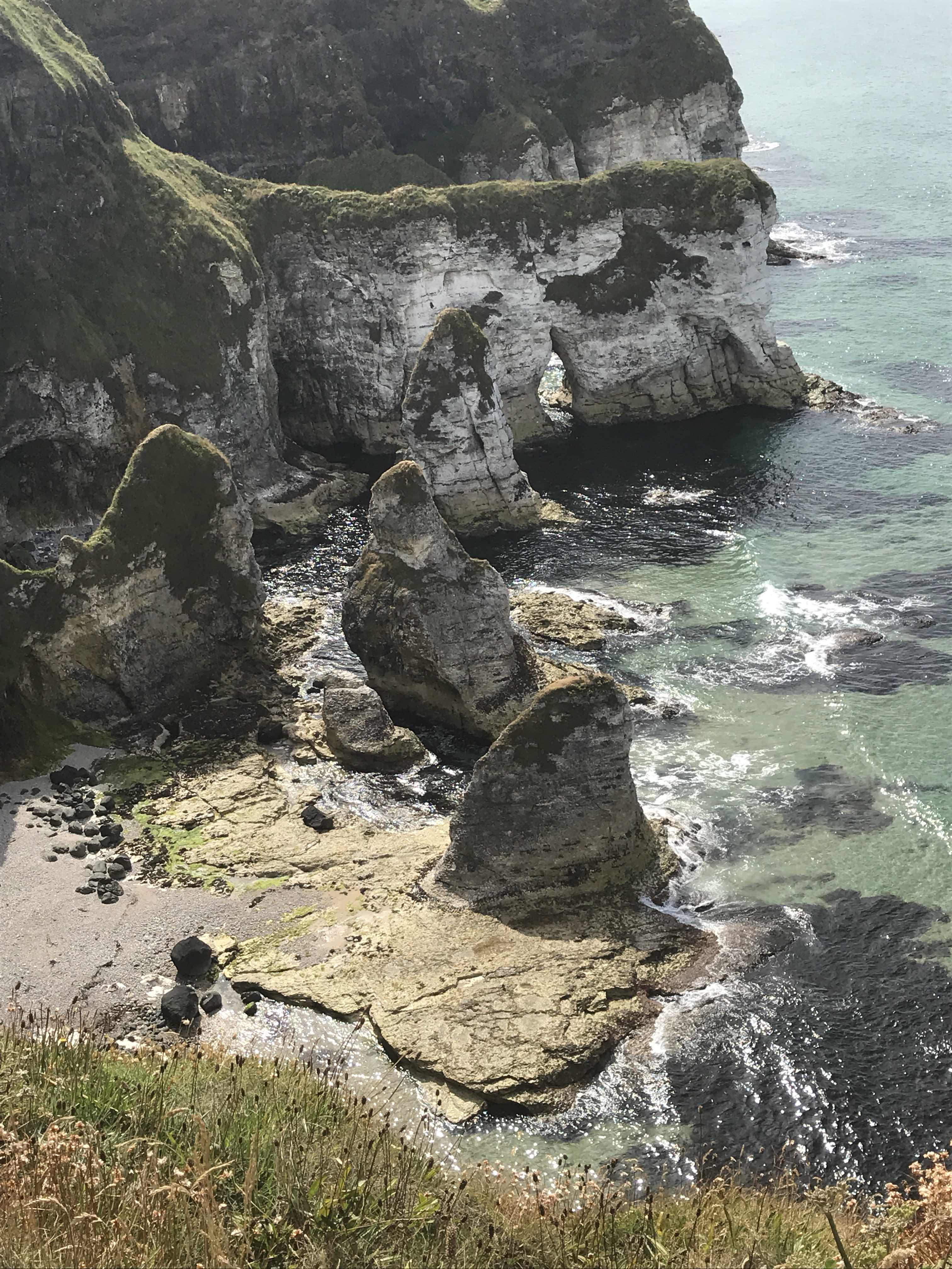 |
| Weird and wonderful shapes worn into these chalky cliffs |
 |
| Lots of roadworks along the way with lengthy delays. This sign had a changing message to entertain the motorists as they waited to get moving again. |
No comments:
Post a Comment